This article is 17 years old. Images might not display.
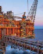
New Plymouth-based company operations manager Bruce Morris said once the rig has finished drilling offshore Pohokura gas field development wells and has undergone maintenance and repair work, it will move to the Awakino South-1 wellsite in licence PEP 38479, and spud the well about 7km off the north Taranaki coast in early August.
Morris said Discovery Geo, and fellow Texas-based companies Manti Resources Incorporated and MM Cone Incorporated, would target a sub-thrust in the Eocene-aged Mangahewa Sandstone Formation, with the well being drilled to a target depth of about 3000m.
The shallower Tikorangi Limestone Formation would be a secondary target.
Once the deviated well has been drilled to the target depth, a lateral will be drilled horizontally through the Tikorangi limestones. This would test shows recorded in the limestones when then state-owned Petrocorp Exploration drilled the Awakino-1 well in 1985.
Morris said Awakino-1 had had several kicks while drilling through the Tikorangi, but that it did not reach the deeper Mangahewa formation, which is widespread over parts of northern Taranaki.
The often fractured Tikorangi limestones could be prolific producers, according to Morris.
The onshore Taranaki Waihapa field gushed more than 10,000 barrels per day in the late 1980s, making it one of the best producing onshore fields in New Zealand or Australia at that time. However, that field has produced less than 1000bpd for several years.
Meanwhile, Discovery Geo is also planning to acquire about 500km of 2D seismic in its other offshore New Zealand licence, PEP 38343, as a follow-up to two earlier 2D surveys.
This is to better define prospects for possible drilling either late this year or in 2009, depending on rig availability, according to Morris.
Discovery Geo, which owns 100% of the Cook Strait licence, is planning to use the Discoverer II seismic survey vessel, which is working in several Great South Basin permits for Austrian firm OMV and partners.
Discovery's seismic would cover the Campbell lead, off Cape Campbell on the eastern coast of Marlborough in the South Island, as well as other potential leads further east and south off the Marlborough coast, Morris said.
The PEP 38479 partners are operator Discovery Geo Corporation (62.5%), Manti Resources (25%) and MM Cone Incorporated (12.5%).


